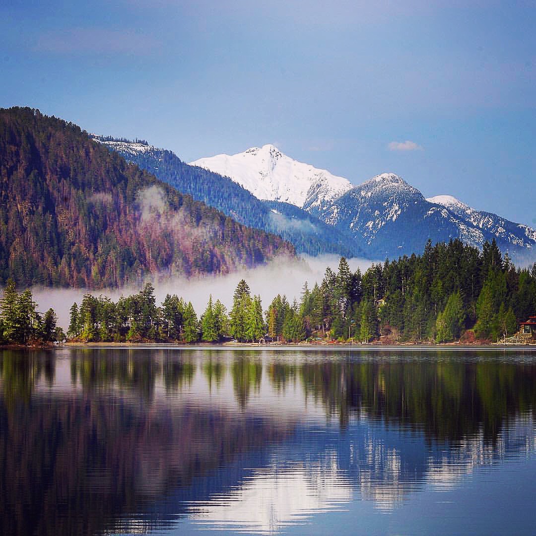
The Alberni Valley offers many opportunities to see its natural beauty – explore the many trails in the area today! Use the interactive map below to find a route and important trail information. For more details, click on a route and follow the link to learn more about each trail. Please use respectful trail etiquette by sharing the trail, leaving no trace and being adequately prepared for your activity.
Download the trail data for your own use by visiting the Google Map, clicking the drop-down menu and selecting “Download KML”. Also visit AllTrails for more trail fun!
Select from the links below to view general information on the following trails:
Carriere to Ship Creek Trail
Cherry Creek Trail
Fir Baby Trail
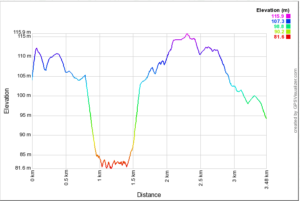
Hydro Row Trail
Kitsuksis Dyke Trail
Log Train Trail (Roger Creek)
Lower Dry Creek Trail
Scott Kenny Trail
Click here for more Sports Fields, Parks, & Municipal Facilities.
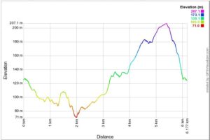
Carriere to Ship Creek Trail
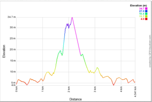
- The Carriere to Ship Creek Trail is a marked route along the eastern boundary of the community that serves as an important link in the regional trail system. Completed in 2008-2009 with funding provided through the Provincial Community Development Trust Fund, the trail was built by local forestry workers impacted by a downturn in the sector.
Starting at the Carriere Road entrance, the trail runs west along Dry Creek before descending to a dramatic high-level crossing of the creek. After rising back up to the ridge, it then heads south to the community boundary near Ship Creek Road. The trail winds through beautiful forested areas with numerous short connections back into adjacent neighbourhoods.
This trail provides a direct link between the Log Train Trail and the Alberni Inlet Trail - Stage 1. Those seeking an extended hike or run can easily combine the trails for a challenging adventure through some of the Alberni Valley's most iconic natural areas.
|
Cherry Creek Trail
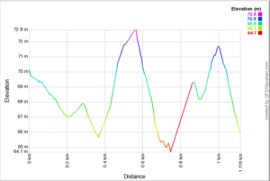
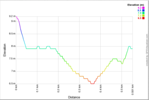
- Running along the city's northeast boundary, Cherry Creek Trail is a gentle 1.13 km soft surface path that provides nice views and access to the creek below. The trail is most easily accessed from McBride Street or by parking nearby John Howitt Elementary School. Heading eastward, the trail crosses Cherry Creek and runs along an open meadow where deer and other wildlife can be often seen (**please note that this is private property). An easy loop can be made by simply crossing the bridge along Cherry Creek Road and walking back through the Grieve Park neighbourhood.
There are a number of benches installed along the main trail that provide ideal resting spots or to simply relax and take in the views over Cherry Creek. This trail is popular with both dog walkers and bicyclists however, there are some steep grades near the creek crossing at the western end
 |
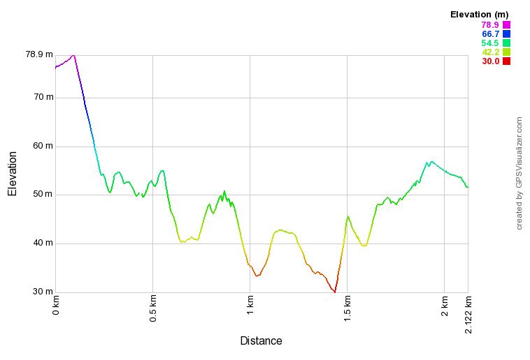
Fir Baby Trail
- Fir Baby is a relatively new trail within the Alberni Valley that was developed by local mountain bike users. The trail is also popular with trail runners and hikers alike due to the gentle grades and flowy trail features. Fir Baby winds its way through a mature forest and crosses numerous small creeks.
For mountain bikers, Fir Baby is an intermediate level flow trail with a number of natural features. Located in close proximity to town, the trail is popular with local riders and is well known for its fast turns.
 |
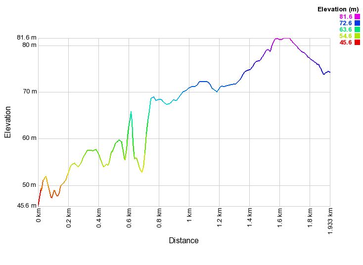
Hydro Row Trail
- Hydro Row Trail is a gentle 1.9 km trail that connects the Scott Kenny Trail to the nearby Log Train Trail entrance adjacent to West Coast General Hospital. From the southern entrance the trail follows underneath the hydro transmission line until reaching the Roger Creek ravine where it heads west along the top of the bank. This is a nice forested section of the trail that winds behind the North Island College campus before exiting into the rear parking lot of the Athletic Hall, Alberni Valley Multiplex, Glenwood Center, and Fall Fair grounds. Keep to the north side of the parking lot, following along the top of the ravine and you will eventually connect with the Scott Kenny Trail.
 |
Kitsuksis Dyke Trail
- The Kitsuksis Dyke path is one of Port Alberni's most popular urban walkways. Developed along both sides of Kitsuksis Creek, the paved path intersects both Blair Park and Spencer Park with many amenities including washrooms, playgrounds, play fields, and picnic areas. At the north end of the trail a dirt path continues upstream to a small waterfall below the trestle over Kitsuksis Creek. Towards the south end, trail-goers can access Victoria Quay by crossing Highway #4 near the confluence with the Somass River.
This area is very popular with dog walkers who can also make use of the off-leash dog park located in the former baseball field adjacent to Beaver Creek Road.
 |
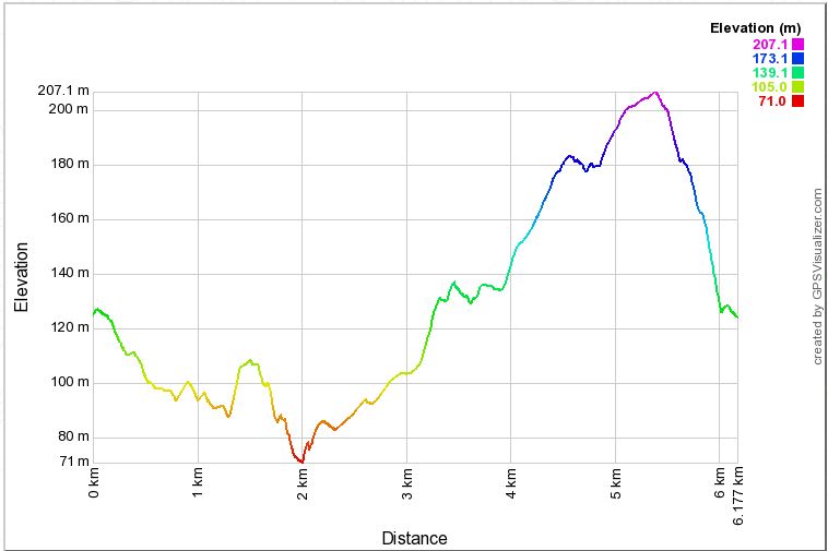
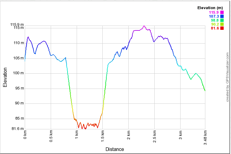
Log Train Trail (Roger Creek)
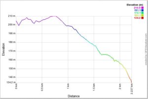
- The Log Train Trail is a historic rail bed originally developed in the early 1900’s as part of the Bainbridge Mill rail-logging operation. The main section of the trail stretches for 25 kilometers along the foot of the Beaufort Range. Information pertaining to this primary section of the trail can be found at the Alberni-Clayoquot Regional District
The Roger Creek section provides for numerous entry and exit points, making it suitable for shorter an extended trips. Many users often connect this section of the trail with further trips along the Log Train Trail to the north or onto the trails connecting to Ship Creek Road and the nearby Alberni Inlet Trail.
Trail users can enter this section at either the south or north end with parking available off Burde Street and the Port Alberni Highway. Aside from the Roger Creek ravine, the trail is level grade and therefore easily accessible. Descent into the ravine is steep so users are encouraged to exercise caution.
 |
Lower Dry Creek Trail
- Running parallel with one of Port Alberni's busiest commercial corridors, Dry Creek Trail provides a short reprieve from the hustle and bustle of lower 3rd Avenue. The trail was completed in 2016 as part of Dry Creek Improvement Project, a $2.7 million infrastructure project undertaken to reduce the flood risk by widening the channel base and reconstructing the side slops. The project also benefited local fish species and their habitat, improving migration, spawning and rearing conditions throughout the creek. These works are evident by looking along the channel from the trail.
The trail runs directly along the creek and behind the many businesses along 3rd Avenue. Although not paved, it is level grade and therefore well suited for families with bicycles and strollers. Looking west across the creek, trail-goers can observe the operations at Western Forest Products - Somass Division.
 |
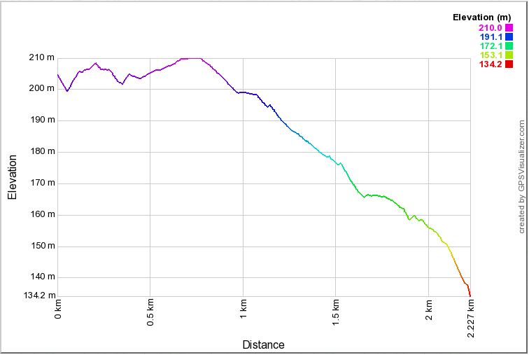
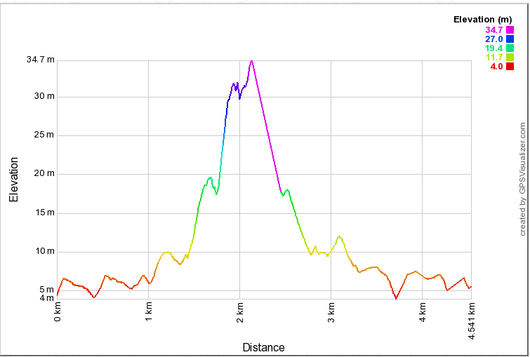
Scott Kenny Trail
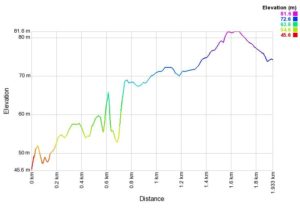
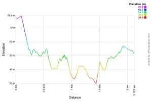
- Scott Kenny Trail is a new multi-use trail that crosses the Roger Creek ravine between Cherry Creek Road/Tebo Avenue and near 10th Avenue behind Glenwood Center. The trail provides a 2.1 km crosstown connection between the north and south sides of Port Alberni which were historically two separate communities. Steep shale walls on both sides of the ravine make for a quick descent to the expansive ravine bottom where a foot/bicycle bridge crossing of Roger Creek is provided. Trails users who don’t wish to descend into ravine can follow the trail along the plateau around which two arms of the trail go before connecting below.
The trail is named after Scott Kenny, the City’s former Director of Parks, Recreation and Heritage, who is passionate about connecting people with nature and led the development of this trail and many others. The creation of the trail was done in partnership with West Coast Aquatic, who undertook significant salmon enhancement work with the creation of off channel habitat for coho, chum, cutthroat, steelhead and pink salmon. The trail affords excellent views and access to these enhancement works, located nearby the bridge over Roger Creek.
 |
For more information, please contact
Echo Centre Front Desk
4255 Wallace St
Port Alberni BC V9Y 3Y6
Telephone:
250-723-2181